Before putting money into any Northeast Ohio real estate asset, verifying the property’s structural and legal standing is your ultimate safety net. Stark County Auditor’s parcel data serves as the central source of truth for local homeowners, builders, and appraisers looking to confirm exact acreage, review historical sales data, or run a Stark County GIS map query. By utilizing powerful online search frameworks provided by the county, stakeholders can bypass traditional bureaucratic hurdles and instantly access live parcel cards, valuation metrics, and zone overlays without leaving their desks.
The Statutory Framework of Stark County Land Records
A common point of confusion for out-of-state investors is understanding which local government entity holds administrative dominion over specific property datasets. Stark County utilizes a decentralized layout where three main offices coordinate real estate records under the Ohio Revised Code (ORC).
- The Stark County Auditor: Serving as the chief fiscal officer, the Auditor maintains the Computer-Assisted Mass Appraisal (CAMA) database, determines market values, tracks property characteristics, and issues unique 7-digit parcel identification numbers.
- The Stark County Treasurer: Responsible for the collection of real estate taxes, administering specialized payment plans, and managing structural tax liens or delinquency portfolios.
- The Stark County Recorder: The official depository for legal property titles, handling the recordation of warranty deeds, mortgages, easements, and plat maps.
Core Parcel Data Elements and Administrative Authorities
When pulling a property card or running a digital title audit, you must cross-reference information across specialized data layers. The table below outlines the core components found on a standard Stark County parcel profile.
| Property Data Layer | Primary Statutory Metrics | Primary Administrative Authority |
| Fiscal Valuation Summary | Market Value, Taxable Assessed Value (set at 35% of market value by Ohio law), and CAUV agricultural metrics. | Stark County Auditor |
| Physical & Structural Traits | Total finished living area, foundation footprints, mechanical systems, construction year, and building sketches. | Stark County Auditor (CAMA Division) |
| Legal Title & Sales History | Recorded conveyance fees, deed transfer instruments, previous sale prices, and grantor/grantee tracking. | Stark County Recorder |
Step by Step Guide: Executing Digital Parcel Audits
To audit a parcel’s standing, execute this step by step framework through the official county web interfaces.
Step 1: Query the Stark County Real Estate Search Portal
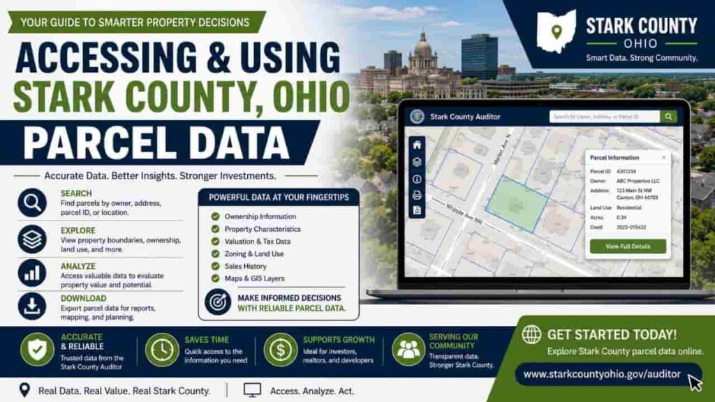
Launch the official Stark County Auditor Property Search portal (realestate.starkcountyohio.gov). This system allows you to locate assets using four distinct inputs.
- Parcel ID Search: Input the exact 7-digit county key number to pull up a single property card instantly.
- Owner Name Search: Look up portfolios by typing an individual’s last name or a corporate entity name (e.g., an LLC).
- Property Address Search: Input the structural address. Pro Tip: Keep street suffixes (like Road, Avenue, or Boulevard) abbreviated to match the county’s index layout.
- Geographic Boundary Search: Search by subdivision plats, lots, or outlots across specific townships and cities.
Step 2: Extract Fiscal Valuation Records
Once you open a property’s core profile page, navigate to the valuation tab. Under Ohio property tax guidelines, taxes are not computed directly from full market value.
Assessed Taxable Value = Auditor Market Value x 0.35
Review these numbers carefully. If the Auditor’s market value significantly exceeds actual market conditions, you can file a formal valuation complaint with the Stark County Board of Revision (BOR) between January 1 and March 31 annually.
Step 3: Analyze Structural Characteristics and Property Cards
Review the physical details block to verify the property’s accurate footprint. This includes total square footage, bathroom counts, and outbuildings like detached garages. Discrepancies here can directly skew your appraisal values and property tax liabilities.
Step 4: Trace the Recorded Chain of Title
Examine the transfer history table to see past sale prices, conveyance numbers, and deed types (such as a General Warranty Deed or a Sheriff’s Deed). Cross-reference these listings with the Stark County Recorder’s deed lookup system to confirm there are no unrecorded easements or ownership gaps.
Step 5: Launch the Advanced Stark County GIS Parcel Viewer
Click the map interface link to transition from flat textual data to spatial maps. The Stark County GIS Hub provides interactive geographic tools to evaluate site constraints.
Open GIS Viewer ➔ Input Parcel ID ➔ Toggle Aerial Imagery ➔ Overlay Zoning or Flood Hazard Risk Layers
This interface lets you view precise lot dimensions, check public right-of-way boundaries, analyze localized zoning codes, and verify if a parcel sits in a regulated FEMA flood zone.
Mitigating Investment Risks via Public Data
- Audit Legal Nonconforming Uses: Verify if a building’s physical use aligns with current municipal zoning overlays. If a commercial asset sits inside a residential zone under a “grandfathered” status, an operational vacancy lasting more than 12 consecutive months can permanently strip the property of its commercial rights.
- Track Delinquent Tax Liens: Always check the Stark County Treasurer’s Payment Portal to verify current balances. Unpaid property tax assessments remain attached to the real estate itself, meaning an investor could unknowingly inherit thousands of dollars in back taxes upon closing.
FAQs
Is Stark County parcel data free to access online?
Yes. All basic parcel details, including valuation summaries, historical sales records, tax charges, and spatial GIS maps, are completely free to search via the official Stark County Auditor website.
Do I need an account to use the county property search engine?
No registration is required. The public search portal and Stark County GIS Hub are fully open-access tools designed for seamless public reference 24/7.
Can I download scalable property maps from the GIS system?
Yes. The Stark County GIS interface allows you to print custom maps, download shapefiles, or export raw parcel reports directly into CSV or GeoJSON formats.
How often is the online parcel data updated by the county?
The property database is updated regularly by the Stark County Auditor’s Office, though recent deed transfers may take several days to reflect on the web portal.
Where do I get official certified copies of property deeds?
Certified deed instruments are not available on the property search index. You must request official records directly from the Stark County Recorder’s Office on Central Plaza.